

(You can't even see Japan in the first map.)
From the National Research Institute for Earth Science and Disaster Prevention website, "Hypocenter map".
Last 30 days: Last 7 days:
 Last 24 hours:
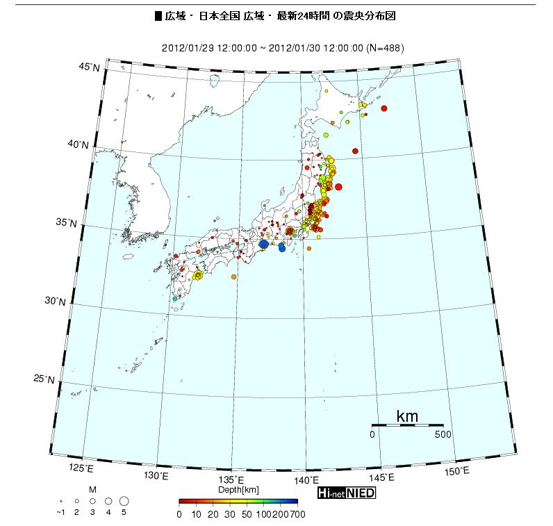
A lot of Magnitude 4 quakes, and a good number of Magnitude 5 quakes. M5 is moving to the central Japan, right near Mt. Fuji. Numerous small, shallow quakes in western Japan.

 Tokyo Time
![[Most Recent Quotes from www.kitco.com]](http://www.kitconet.com/charts/metals/gold/t24_au_en_usoz_2.gif)


7 comments:
I hope all the lamebrained HAARP proponents take a GOOD LOOK at the seismic activity that continuously rocks Japan and then shut the fuck up already.
1990-2006 seismicity map of Japan. Yeah, blame it on CRAAP, LOL.
http://earthquake.usgs.gov/earthquakes/world/japan/seismicity.php
So, is there really smoke coming out from Fuji-san? More precisely, from the side where new crater would be formed if eruption is to happen.
There is so much talk on other forums (jp), together with pictures of white volutes above.
Looks to me like NPPs in Japan are pure insanity!!!!
Last night they had a program in which a specially made destruction ball was pitted against a super reinforced wall on TV here. The ball won.
Fujisan "smoke" was quickly busted by local residents. They were clouds.
Hi,
First internal irradiation map :
http://www.keitousagi.com/
Post a Comment