

A sublime piece of art, unintended though it may be.
Photograph from a book titled "Nihon Rekishi Saigai Jiten (encyclopedia of historical disasters in Japan)" compiled by Itoko Kitahara, Ritsuko Matsuura, Reo Kitamura, published by Yoshikawa Kobunkan, 2012. The location is Maehama, Noda-mura, Iwate Prefecture.
北原糸子・松浦律子・木村玲欧編『日本歴史災害事典』(吉川弘文館、2012年)岩手県野田村前浜付近
(Click to enlarge)

The person who tweeted this photo says he can tell the book is the fruit of the long labor by the authors.
 Tokyo Time
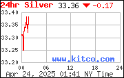
![[Most Recent Quotes from www.kitco.com]](http://www.kitconet.com/charts/metals/gold/t24_au_en_usoz_2.gif)


6 comments:
This is an incredible photo, but I came to this site hoping to find information on current radiation levels in air, water and on the ground in cities and regions around Japan. Could somebody please inform if such a site--preferably non-governmental--exists (also Japanese language site OK). Contact me at
atomiclobotomy@gmail.com. Thanking you in advance for any info.
This could be a modern day "Great Wave off Kanagawa".
Radiation map
http://jciv.iidj.net/map/ge
http://jciv.iidj.net/map/list
http://fleep.com/earthquake/
OT: I wonder if this will become a problem around Fukushima?
Much of the 30km exclusion zone around the Chernobyl nuclear plant is pine forest, and some of it so badly contaminated that a forest fire could create a devastating radioactive smoke cloud.
http://www.bbc.co.uk/news/magazine-18721292
The roof of the house, if that is what it is, on the right in the background reminds me of Mt. Fuji.
Safecast public radiation monitor.
Within weeks, Bonner and his team created a handmade Geiger counter connected with a GPS feature that he calls "bGeigie," a reference to Japanese-style "bento" lunchboxes. It is attached to cars and takes a reading every five seconds, resulting in a massive store of data. There are 30 to 35 such mobile devices traversing Japan and 320 fixed devices.
Safecast made the technology and the data open, sharing the design and findings, and has now collected more than 3 million measurements across Japan. Other volunteers have developed online maps with the data.
"There was no data that was available anywhere, and we were rather surprised," Bonner said during a trip to Japan last week to meet with volunteers. "We realized that we could help." Safecast says it is currently focused on Japan but would like to provide data on a global level.
http://blog.safecast.org/
http://ajw.asahi.com/article/0311disaster/fukushima/AJ201207090111
it's beautiful
Post a Comment